Mid summer of 2021 we started construction of the second phase of the Red Grade Trails System. Much of this phase is complete and now open as mixed hiking, biking, and equestrian trails.
Two parking areas / trailheads will be created in summer 2022.
Later in the summer of 2022 we will start the third phase of construction will will provide a connection for hikers and bikers from the lower trails to the upper trails.
We are excited to open additional portions of the trails being developed for Phase 2 of the Red Grade Trails System. Huge shout out to Sheridan County, Wyoming Business Council and all of our amazing community members who pitched in to help. A big thank you to the crew from Gumption Trail Works and for our past Trail Builder, Ronnie Wagner, for their work to bring these wonderful additions that will help you explore our beautiful Bighorns backyard. We know you’ll love it!
Signs and kiosks are coming and will be installed once these trails are complete.
West Segment – Main Trail – Name TBD
- Length Open: West segment is 3.25 miles from the future Poverty Flat Parking Lot to the junction with Shared Equestrian Trail Spur (see below).
- Use: Open to hiking, biking, walking, running, photography, bird and wildlife watching, yoga and more. Pets are welcome. Horses are welcome for the first 1/4 mile of this trail from the Bear Gulch East Parking Lot. Equestrian users can then connect to the Shared Equestrian Trail Spur – see below. Additional equestrian trails in the vicinity are coming soon.
- Description:
- From the future Poverty Flat Parking Lot – The trail is just above the future lot. At this time it ties to the gravel road just past the future lot. The trail climbs west to just below the radio tower an then maintains the ridge before dropping down to the future Bear Gulch East Parking Lot. The last 1/4 mile to the Bear Gulch East Parking Lot is just mowed at this time.
- From the future Bear Gulch East Parking Lot – The trail leaves the future lot to the east. At this time the first 1/4 mile is just a mowed path until the parking lot is constructed. The entrance to the trail is marked by a series of rock cairns until you get to the sagebrush. You climb the ridge fairly quickly and have some amazing views along the way. From here it is mostly flat until the trail drops down to the future Poverty Flat Parking Lot.
- Length Open: The Shared Equestrian Trail Spur is 3 miles from the future Bear Gulch Parking Lot to the current end of the constructed trail. Equestrian users enter from the future Bear Gulch East Parking Lot. Those on foot or a bike can access this spur trail from either the future Poverty Flat Parking Lot or the future Bear Gulch East Parking Lot.
- Use: Open to hiking, biking, equestrian, walking, running, photography, bird and wildlife watching, yoga and more. Pets are welcome.
- Description:
- From the future Poverty Flat Parking Lot – Those on foot or bike can access the Trail Spur from the future Poverty Flat Parking Lot via the Main Trail. After Main Trail leaves the forest and begins to descent to the future Bear Gulch East Parking Lot take a right to access the Spur.
- From the future Bear Gulch East Parking Lot – Those on foot, bike, or horseback can access the Trail Spur from the future Bear Gulch East Parking Lot via the Main Trail. After climbing about a 1/3 miles on the Main Trail the Trail Spur heads off to the left.

Enter the West Segment here from the future Poverty Flat Parking Lot
East Segment
- Length Open: East segment is 1.5 miles from the future Poverty Flat Parking lot to the current end of the constructed trail.
- Use: Open to hiking, biking, walking, running, photography, bird and wildlife watching, yoga and more. Pets are welcome, although horses are prohibited on this current stretch of trail. Equestrian trails in the vicinity are coming soon.
- Description: The trail descends just below the top of the ridge and then maintains the contour while heading east. Please turn around at the “trail closed sign”. We plan to continue to opening additional distance on this trail as the construction progresses.
- Advice from Ronnie: Please be sure to stop and turn around when you see the “Trail in Progress. No Trespassing.” sign. The trail beyond this sign is under construction and extremely sensitive to use in such dry conditions. There is also an expert feature warning sign on the trail. It is very noticeable and well marked before the feature.

From the future Poverty Flat Parking Lot – Enter the East Segment here. Follow the pink flagging to get to the new trail.

The end of the East Segment – for today. This sign will move down the trail as more trail is ready for visitors.
Information for both West and East Segments
- Directions: From Sheridan, travel south on Highway 335 for roughly 10 miles from the intersection of Brundage Lane and Coffeen Avenue to where the road become gravel and the road is known as Red Grade Road. Continue another 4.1 miles on Red Grade Road and turn right onto Forest Service Road 318.
- Parking:
- Future Poverty Flat Parking Lot – Please park along Forest Service Road 318, Road 317 or at the location of the future Poverty Flat Parking Lot. Directions via Google Map.
- Future Bear Gulch East Parking Lot – continue 1.9 miles past Forest Service Road 318 on Red Grade Road. Parking is a large dirt pull off on the right just before you cross the cattleguard. Directions via Google Map.
- Access: Enter the west trail from the large camp behind the trees (off FS 318 about 0.3 miles from Red Grade Road). For the west segment head west up the hill past a brush pile. The west trail enters the forest to the left and quickly becomes apparent. For the east trail head east from the camp across the FS 318 road and follow the pink flagging hanging from the trees. The east trail enters the forest and quickly become apparent.
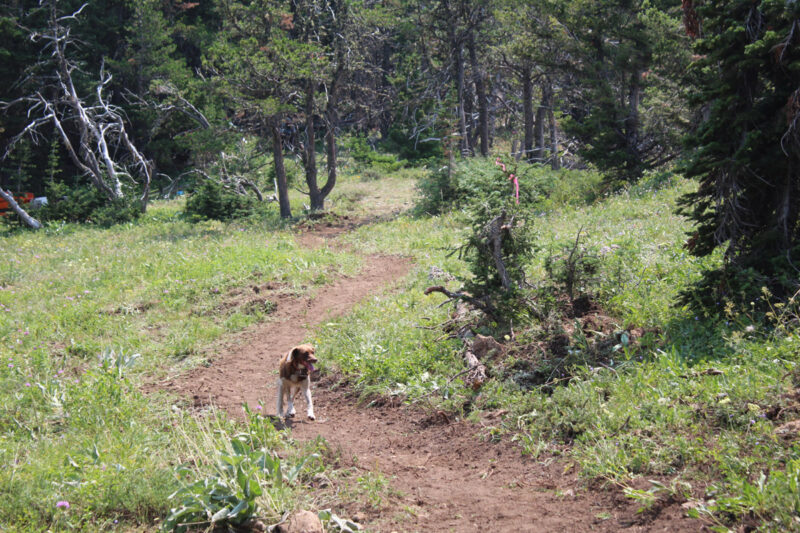
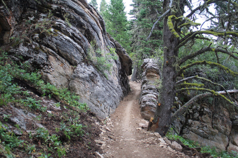
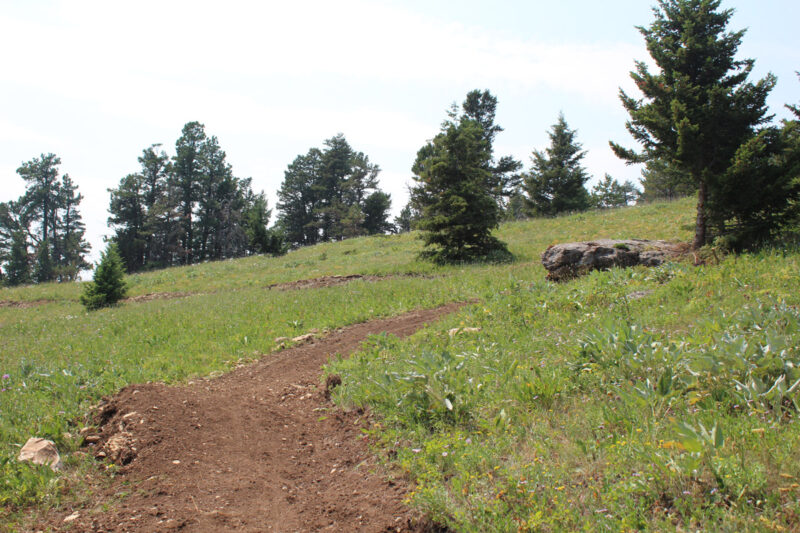
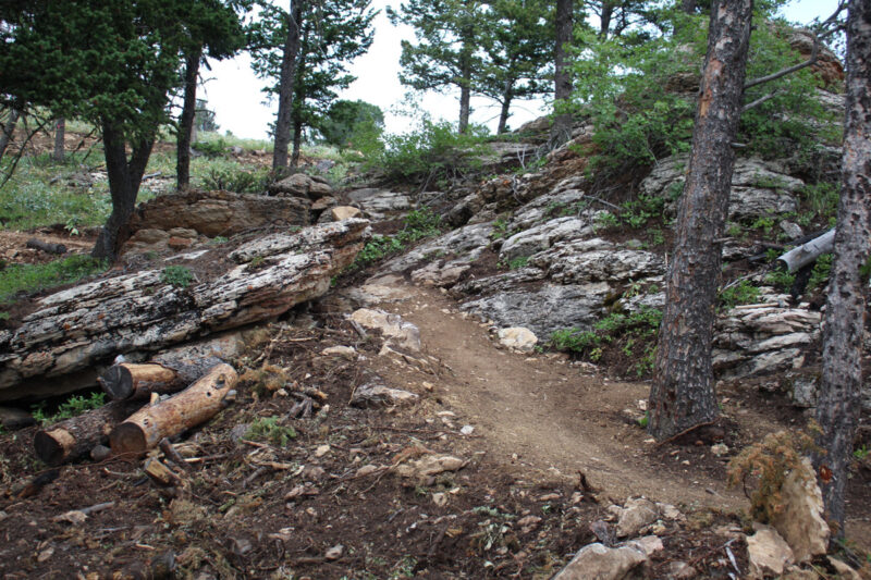
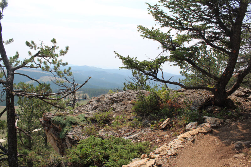
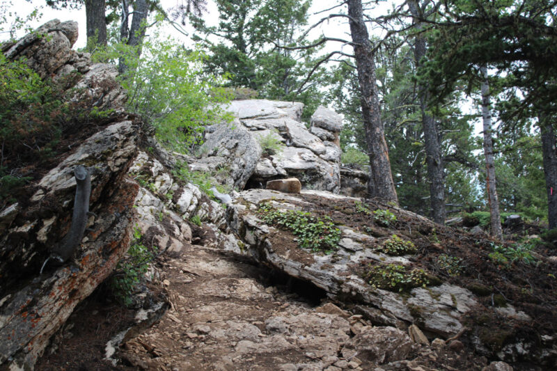
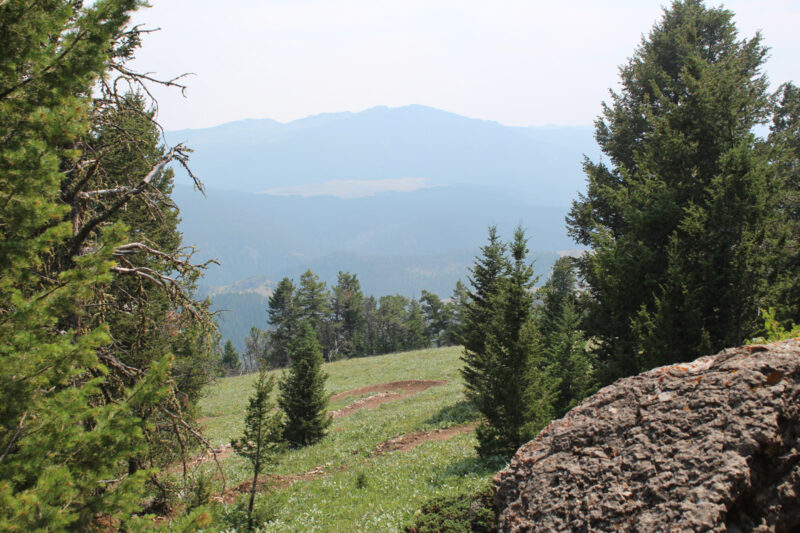
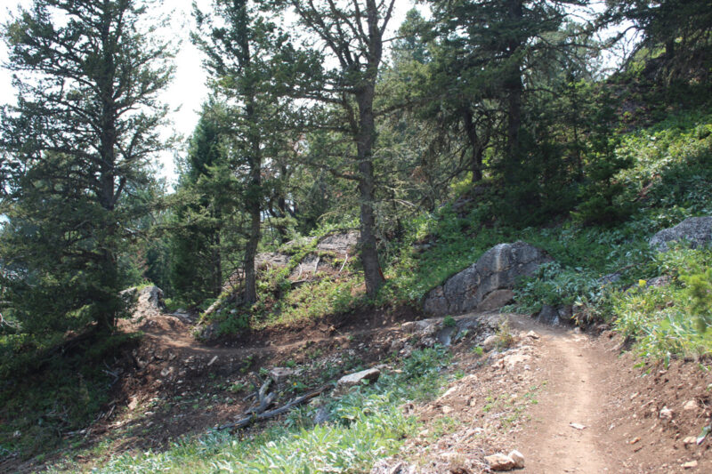
Here are some scenes from the West Segment you can enjoy today!
Why Community Trails Matter
We work to create Now, more than ever, access to the outdoors is essential to our physical and mental health. SCLT’s growing network of community are visited more than 20,000 times each year, in part, because they make going from your front door to the outdoors easier than before in Sheridan County.
Why are these trails so important?
Below, is a video made by Hesid Brandow and Kevin Knapp about why the Tongue River Water Trail matters so much to their family. Calling the Tongue River Valley an “incredible community treasure,” Hesid says the water trail has spurred interest in the streams through Sheridan. “In our decade living here,we have watched as the area has been cleaned up. Our family benefits daily from the well-maintained creek bank and we are constantly reminded of just how fortunate we are to live in a community with a land trust!”