
- Fun Fact: The Basawaxaawúua (Crow for Our Mountains) are ~150 miles long and 30-50 miles wide.
- Bottom lands, plateaus, and pathways.
- 34.9 Miles. 77% Gravel, 23% Paved.
- Difficulty: Easy/Moderate. Rideable: Year-Round.
- Amenities: None. Cell Service: Good.
Route Description
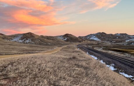
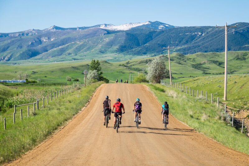
This is a fun and fairly easy town and country ride. You’ll travel a creek valley, span a divide, and ride a pathway.
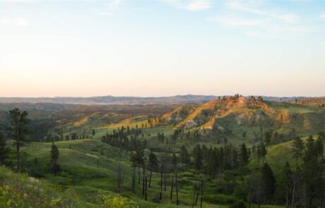
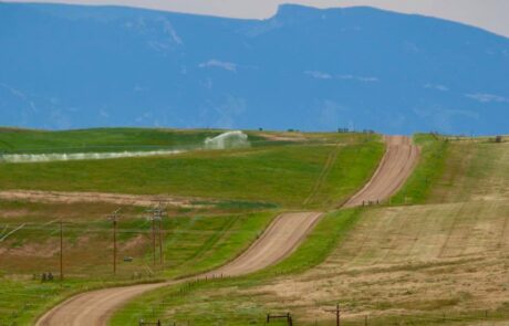
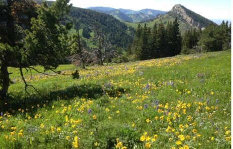
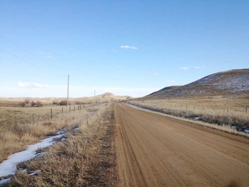
You’ll follow Prairie Dog Creek, one of the valley’s many creeks that flows northward from the mountain. These creeks have carved valleys that are dotted with irrigated farmlands and flanked by rolling hills and high plateaus where the cattle roam.
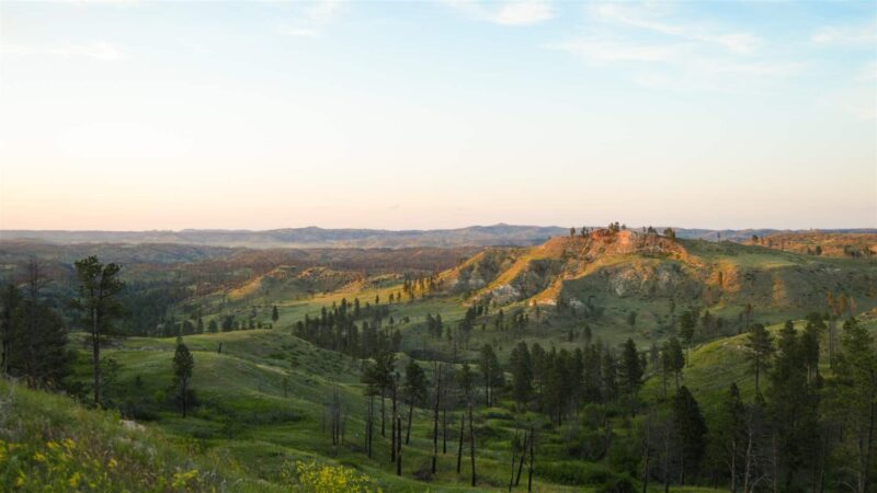
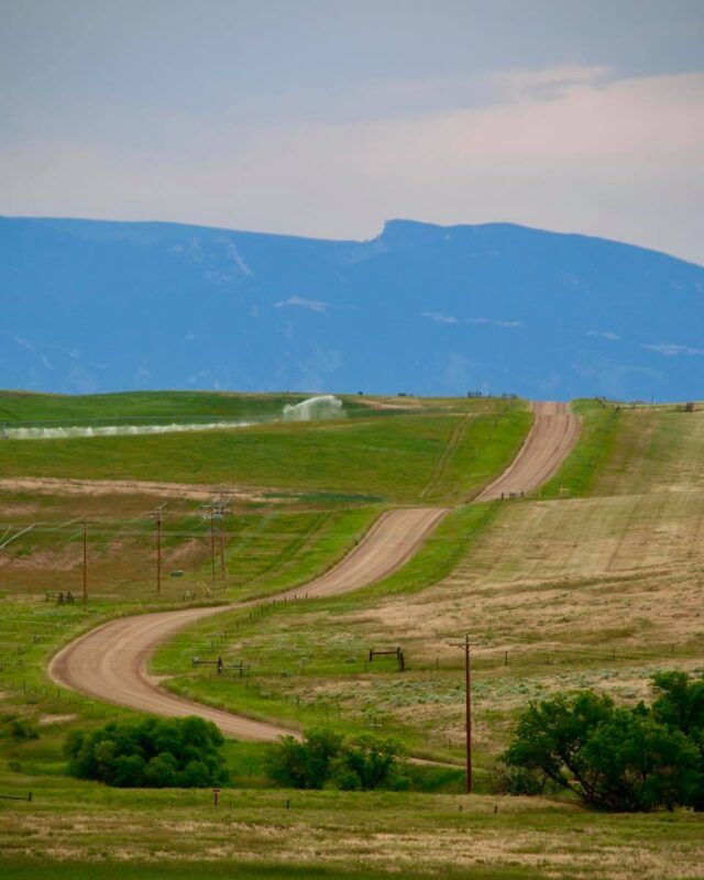
You’ll make a long, slow climb onto the high table land that straddles the Prairie Dog and Tongue River drainages. From here you’ll catch glimpses of the lush Tongue River corridor below and of the vast Sheridan valley out ahead.
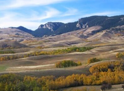
You’ll be at a far enough distance that you’ll see why they say this mountain range rises abruptly from the plains. You’ll also be able to see the expanse of the mountain’s interior, from the jagged peaks and glacier-carved cirques in its center, to the forested, steep canyons trailing down its flanks.
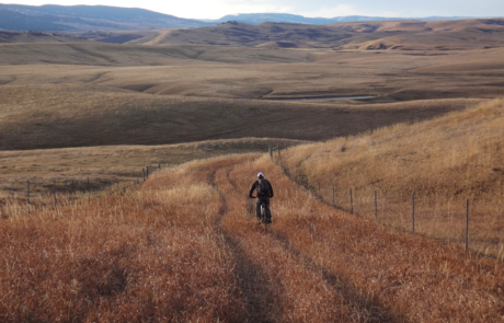
All of the gravel on this ride is firm but you may experience some wash-boarded and pot-holed segments. The roads aren’t hugely wide, but the traffic is minimal so there’s plenty of room for everyone. This ride’s gravel mainly falls within category’s 2-3 on the ISGG, Industry Standard Guide to Gravel.
There’s a great opportunity described below that follows the Tongue River out into the rugged break lands if you want to extend this ride and increase your workout.
Once back in town, a pleasant alternative to the busy city streets is to hop on to the Sheridan Pathways. Link here for map.
Detailed Directions
Locals usually begin at the 5th Street Visitors Center and ride counterclockwise. Leaving the Visitors Center take the Wyarno Hwy (WY 336) eastward out on to the plains away from Sheridan. In ~0.8-mile you’ll stay straight and exchange the pavement for gravel on a road known as the Wildcat Rd. You’ll come to a large Y in the road in ~2 miles. Turn left, taking the smaller gravel road called Wakeley Rd. You’ll cross the paved Wyarno Hwy and ride what’s now called Lower Prairie Dog Rd.
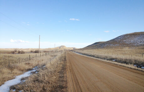
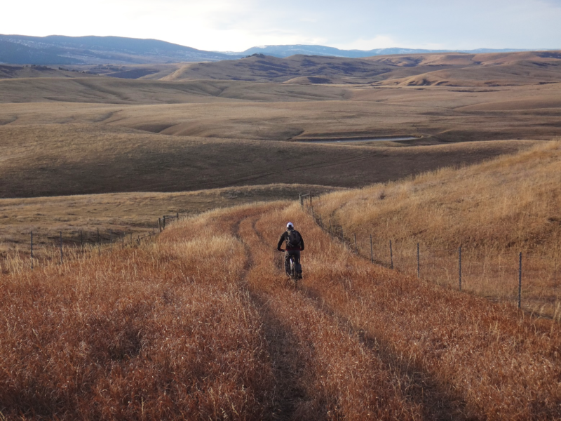
Lower Prairie Dog Rd is straight forward, you’ll be on it for the first third of this ride. Many small ranch and methane roads radiate off all directions but stay trending northward for ~11.5 miles until you turn on to Co. Rd 1231, a large gravel road teeing off to the left called Beatty Gulch Road.
If you want to extend this ride, your workout, and change up your scenery- stay straight. The terrain changes almost immediately. You’re in punchy hill country now. First, you’ll climb and follow the beautiful Tongue River with its borders of cottonwood. Then you’ll wind through rock-strewn mesas punctuated by deep ravines. This is an out-and-back ride, but well worth the effort. The road will take you as far as you want to go.
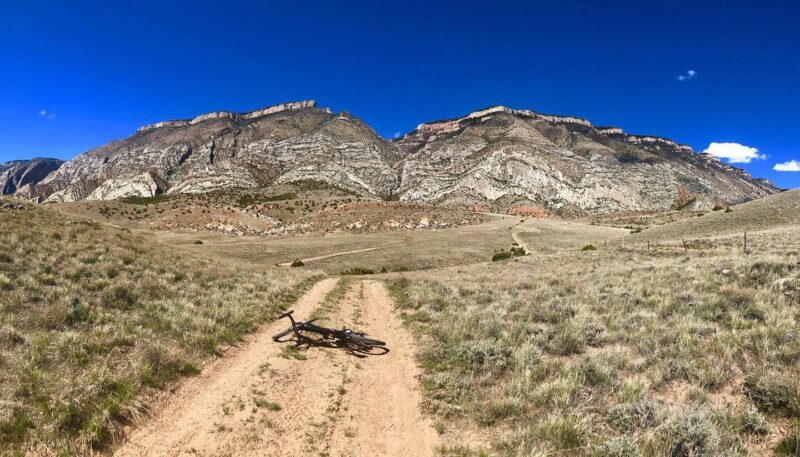
Whether you turn at Beatty Gulch to begin with, or come back to it after a detour, this stretch of gravel covers the second third of your ride. Like Prairie Dog Rd, Beatty Gulch Rd also has many ranch and methane roads radiating from it but hold to the main gravel that trends southward. After ~5 miles, you’ll come to a wide Y in the road. If you prefer to leave the gravel behind, the branch to the right is Beatty Spur Rd and will take you down to the paved Decker Hwy. If not, the somewhat smaller branch to the left is what you’ll ride. This is called the Dietz Beatty Gulch Rd.
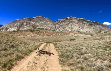
In ~4.4 miles the road will swing westward through a piece of state land. You’ll see an ORV riding area off to your left called the Three Poles, created so people have a natural-terrain motocross track to enjoy. The only amenities here are toilets placed during the summer, handy if needed. Following Three Poles you’ll climb one last hill then have a fast, curvy descent off the table land to the paved Decker Hwy.
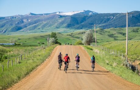
Starting the third all-paved portion of this ride, turn left and head into town. Just down the hill after crossing the freeway you’ll come to Real Bird Way on your right. If you’re interested in riding the City Pathway through town, turn on Real Bird Way and enter the parking lot on your left. This is Malcolm Wallop Park and the very northern portion of the Pathway System. Here, you can also ride The Green Room Trail, a 1.25-mile single-track trail built by SCLT in 2021. On the pathway, work your way to 5th street, turn left, and proceed back to the Visitor’s Center and your vehicle. Or better yet, detour to downtown and check out all Sheridan merchants have to offer.
Quick and Dirty
This is a fun, and fairly easy town and country ride. You’ll travel a creek valley, span a divide, and ride a pathway. The route can be ridden year-round, the gravel is good, and there’s minimal traffic on a fair portion of the route. 77% Gravel, 23% Paved.
Click Here for the GPX file of the route
Click below for an expandable map.
PHOTOS FROM THE ROUTE
SEE OTHER ROUTES
Questions?
Contact Us Today:


