
- Fun Fact: The Bighorns were once known as the Shining Mountains.
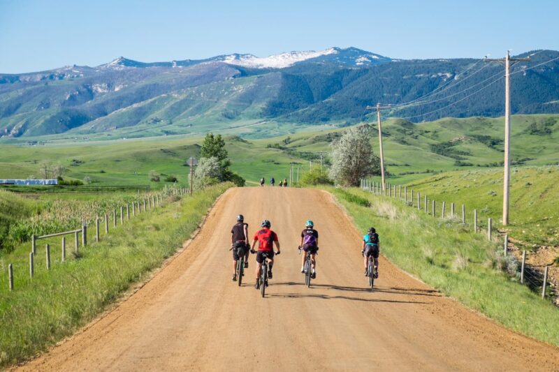
- Mountain riding with several detours to make this a day-long trip.
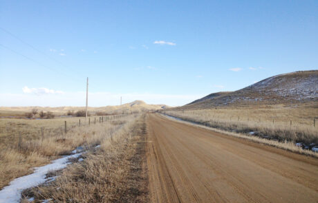
- 15.2 Miles. 100% gravel, all on top of the mountain.
- Difficulty: Moderate. Rideable: Late May to Sept./Oct.
- Amenities: None. Cell Service: Very little, if any.
Route Description
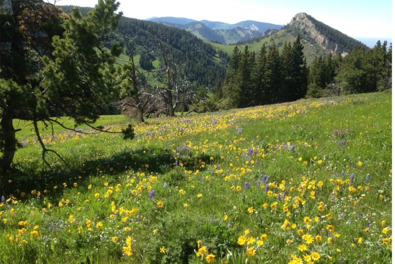
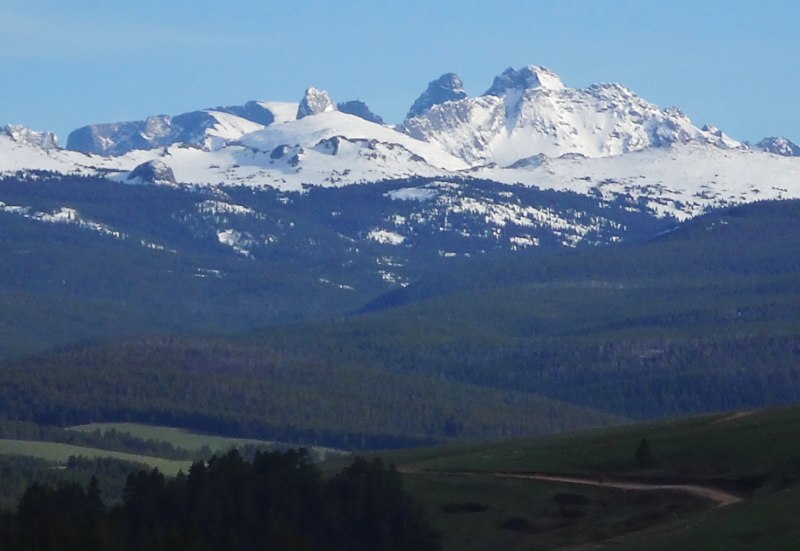
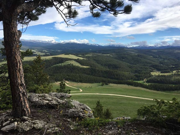
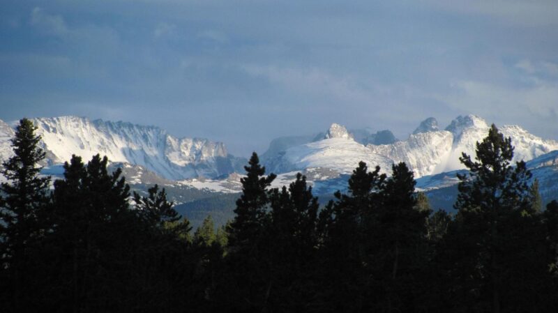
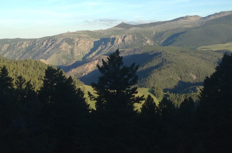
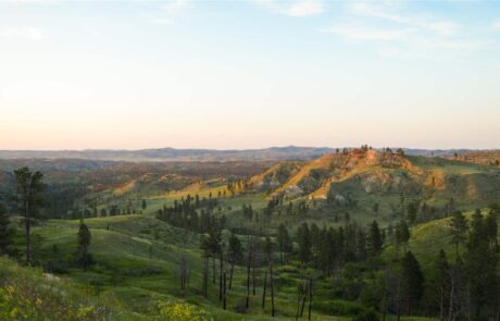
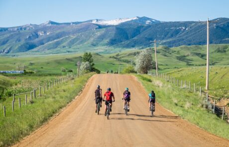
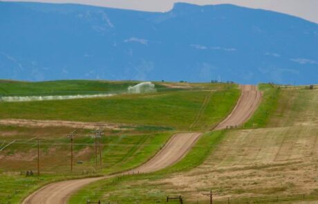
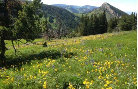
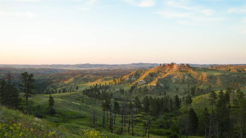
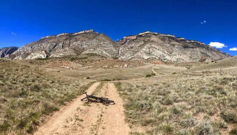
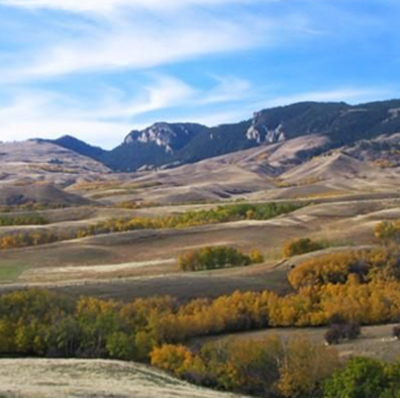
The Bighorns can be seen from a great distance rising out of the basins that surround it, and with the tallest peaks snow-covered year-round, the sun produces a gleam that was once considered a beacon to early travelers. When riding in the Bighorns these peaks will be always present in the background as you pedal your way through forest and across mountain meadows. Abundant wildflowers and wildlife are common sights.
Since there is no cell service to speak of, we recommend you download a map of the area before going. There are no amenities like coffee huts or pubs along this route, so it’s a pack everything you need sort of ride. This ride is also at elevation, around 6,900 to 8,300 feet, and weather changes fast so extra clothing is recommended. On weekends, you may encounter a fair amount of ATV traffic but during the week you may get lucky and have the place to yourself.
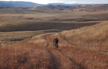
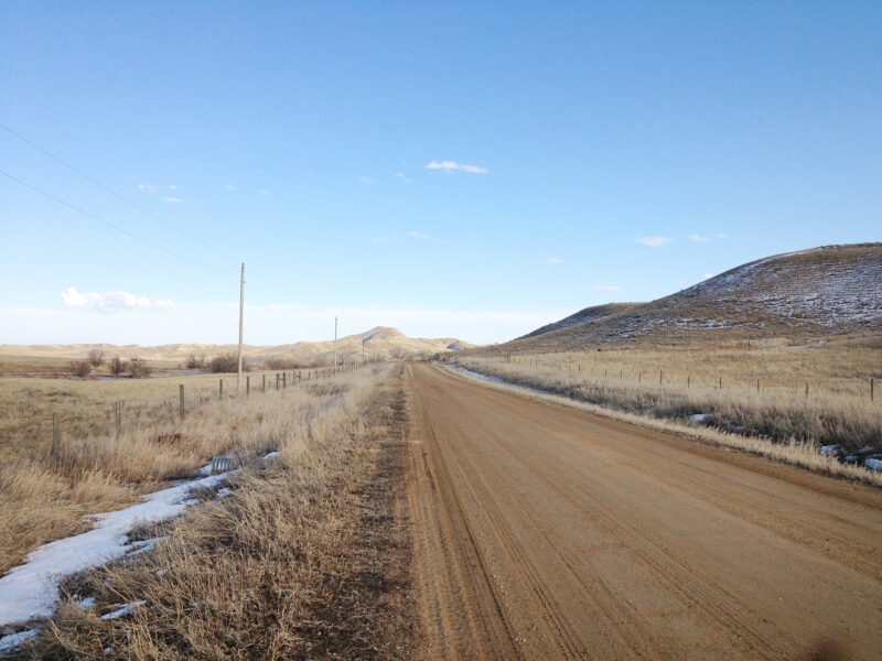
This is rolling hills and punchy terrain with just a slight bit of technical. For being on the top of a mountain the gravel is actually great – mostly fast, hard-packed dirt/gravel with a little rock, looseness, ruts, and rough thrown in. Half well maintained and half not, this ride spans Category’s 2-4 on the ISGG, Industry Standard Guide to Gravel.
Depending on your speed, stops, and detours this ride could be a handful of hours or a full day experience. Note that all spurs described below (except the Park detour) are on rugged roads and include demanding hills to negotiate. Also note that bikes are not allowed in the Cloud Peak Wilderness area.
- Little Goose Falls is one of several popular out-and-back detours, will add ~4.9 miles to your loop, and requires a sizeable river crossing and a short hike to reach the falls. Once there you’ll find a string of deep pools below the falls that are great for cooling down on hot days.
- A detour to the end of Park Reservoir and back will add ~5.8 miles to your ride. Park Reservoir is a large body of water with sandy beaches popular as a weekend hangout for locals enjoying fishing, swimming, paddling, and riding ATVs.
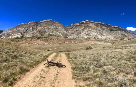
- Beyond Park Reservoir, teeing southward on a very rugged stretch of road is the Cross Creek drainage which adds ~13.3 miles to your ride off the main loop. This out-and-back ride ends at Cross Creek Reservoir and treats you with a spectacular view of the cliffs and chasms that forms this area’s wilderness boundary.
- A detour down Sand Coulee and back will add ~4.8 miles to your ride. The highlight of this, after a descent down a very big hill, is the picturesque East Fork of Big Goose Creek. Crossing the creek, you’ll ride upward through mountain meadows and end in a deep stretch of forest.
Detailed Directions
To access the top of the mountain take Hwy 335 out of Sheridan which becomes Forest Service Road 26, a 34.7-mile-long stretch of gravel known locally as Red Grade Road. If you want a real challenge, park below at one of the trailheads for SCLT’s Red Grade Trails and ride up, either on the road, or if you’re on the right bike, ride the single-track trail that’ll top you out at the Poverty Flat Trailhead (trail coming Fall 2022).
Once on top, you’ll travel a short distance along Red Grade Road and take the left-hand turn at the sign for Little Goose Campground. In ~1,000 feet, before going down the steep hill to Tee Pee Creek, you’ll park in the pull-out to the left as the road enters the trees. This segment of road is called “Evans Road” and is on private land so please stay between the fences and don’t trespass.
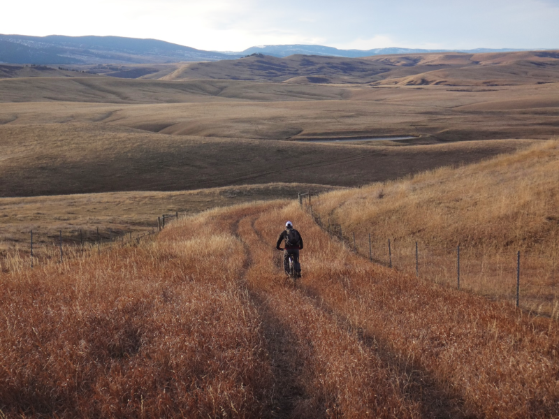
This ride is usually ridden clockwise. You’ll get the worst over with right off the bat. You’ll start with a short but gnarly drop into a creek bottom and a big, long climb out. As you leave the creek bottom, you’ll notice that the main road becomes braided as it goes up the hill and you’ll see several smaller dirt roads teeing off but stay on the main track all the way up. Once on top the sailing gets smoother.
The hardest part now will be finding that 1st important turn. There are no signs. Here’s a description but downloading the route before leaving home is best. Shortly after topping out the main road will swing due west and parallel a fence line heading the same direction. Shortly after that (~500 feet) the main road will turn southward again, dropping to Little Goose Campground. Instead of turning, you will keep to the fence line, continuing straight west on the lesser gravel road. Now you’re on course.
For the next 6 miles you’ll encounter several challenging but manageable hills along the way as you meander west and somewhat southward thru forest and meadow with expansive views of the wilderness area. There are several roads veering off left and right but stay on the beaten path. You’ll know in due time if you have gotten off route because all turns will pitter out one way or another (get smaller, come upon cabins, tee gates into places you shouldn’t go, etc.).
At the end of this stretch you’ll tee a large main road that goes left to Park Reservoir or right back to Red Grade Road. Unless you’re doing a detour, go right. Once back to Red Grade, take a right again and proceed back to Evans Road and your parked vehicle.
Quick and Dirty
This is high mountain riding on 100% gravel. You’ll pass thru forest and wildflower covered meadows with the peaks of the wilderness in the distance. Rolling hills and punchy terrain on mostly excellent gravel with just a slight bit of technical make up this moderate ride. Numerous detours to extend the ride to a full-day experience. Rideable generally late May to Sept./Oct. Pack all you need, there’s no amenities and little cell service.
Click Here for the GPX file of the route
Click below for an expandable map.
PHOTOS FROM THE ROUTE
SEE OTHER ROUTES
Questions?
Contact Us Today:


