Click to download the Red Grade Trails Map
Click to download Red Grade Outreach Timeline
Click to download Red Grade Fact Check Summary
The Buffalo Field Office of the Bureau of Land Management (BLM) is currently taking public comments on their Environmental Assessment of our Red Grade Trails proposal for 33.8 miles of trails on public lands. The BLM will consider these comments prior to their decision on the project. All comments must be received by June 5, 2015.
The US Forest Service will offer a similar public comment process as they complete an Environmental Assessment of the 22 miles of proposed trails on USFS lands. The USFS Environmental Assessment process has not yet begun and is anticipated to be at least two years from completion.
Download the Environmental Assessment document and review the BLM’s press release at http://www.blm.gov/wy/st/en/info/NEPA/documents/bfo/RedGradeTrail.html.
Review the Red Grade Trails Map, Fact Sheet, and Outreach Timeline available above. If you have any questions, please call us at 673 – 4702 or visit our office anytime M-F, 8:30 am – 5 pm at 52 S Main St. Suite 1.
Then, submit comments in any of the following ways:
Email to: buffalo_wymail@blm.gov
Snail mail to: Red Grade Trail Project Environmental Analysis; Attention: Tom Bills, Planning and Environmental Coordinator; 1425 Fort Street, Buffalo, WY 82834.
Fax to: (307) 684-1122
Below are several benefits we associate with the project. Please do NOT copy and paste. Comments need to be original and substantive:
- I have reviewed the EA and find it to be well done and comprehensive in its analysis of the proposed Red Grade Trails project.
- The EA lays out logical and important conditions on a potentially-approved trail system that adequately protect natural resources, viewsheds, and adjacent private property from significant impacts from the proposed trail system.
- The trail design takes into account trail users’ safety and enjoyment by separating uses and designating some trails as single direction, etc.
- The proposed parking locations and enhancements will greatly improve existing and dangerous parking conditions and adequately support the anticipated hikers, bikers, and equestrians that will be using the trail system.
- While it may take longer to build out the project, it is encouraging to see that the BLM took into account the full build-out potential for trails in the area when analyzing the cumulative impacts of the project.
- It is evident that analysis by the BLM was completed in coordination with the anticipated USFS analysis of the same proposed project. SCLT outreach materials and documents further identify the cooperation between these two entities with each reviewing or planning to review the project cumulatively and not in a piece-meal fashion.
Why is it important to comment on the EA:
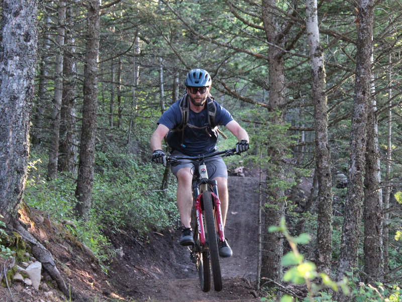
Do you want better access to your public lands? Do you wish you could hike, run, bike, or horseback ride with your family and friends close to home on safe, scenic, and sustainably built trails?
It is critical for the BLM to hear from people who support the project, from those who have questions, and from those who do not agree with it to have an aTo make your voice heard, submit a comment to buffalo_wymail@blm.gov before June 5th when the comment period ends.
Project Background
The concept of the Red Grade Trails System began with feedback from community members who pointed out that the Bighorn foothills lacked safe, scenic, and conveniently located community trails.
The success of this complex, multi-year project will depend on the support of a broad range of committed community partners that share SCLT’s belief that trails help build healthy communities and a thriving local economy.
Project Highlights
- Proposed 33.8 mile non-motorized trail system for hikers, bikers, and equestrians
- Professionally designed to be sustainable, safe, and minimize impacts
- Located entirely on public lands (State, Bureau of Land Management & US Forest Service)
- Construction proposed in 6 phases, with timing contingent on community capacity
- Improves public access experience, making it safer and more sanitary for all recreationists
- Gives Sheridan County a premier local hiking, biking, and equestrian trail system
- Acknowledges and addresses existing trespass, firearm, and management concerns on vicinity public lands
“Everybody needs beauty as well as bread, places to play in and pray in, where nature may heal and cheer and give strength to the body and soul alike.”
John Muir
Colin Betzler
Executive Director
Sheridan Community Land Trust
director@yvo.7d4.myftpupload.com
(307) 673 – 4702